

CUET Preparation Today
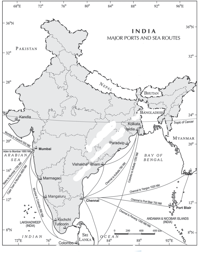
The map below shows the major ports and sea routes of India. Look at the map carefully and name the port based on the given information:
|
This port is confronted with the problem of silt accumulation in the Hugli river which provides a link to the sea. Which port is it? |
Visakhapatnam Port Paradwip Port Kolkata port Tuticorin Port |
Kolkata port |
Kolkata Port is located on the Hugli river, 128 km inland from the Bay of Bengal. Like the Mumbai port, this port was also developed by the British. Kolkata had the initial advantage of being the capital of British India. The port has lost its significance considerably on account of the diversion of exports to the other ports such as Vishakhapatnam, Paradwip and its satellite port, Haldia. Kolkata port is also confronted with the problem of silt accumulation in the Hugli river which provides a link to the sea. Its hinterland covers U.P., Bihar, Jharkhand, West Bengal, Sikkim and the northeastern states. Apart from this, it also extends ports facilities to our neighbouring land-locked countries such as Nepal and Bhutan. |