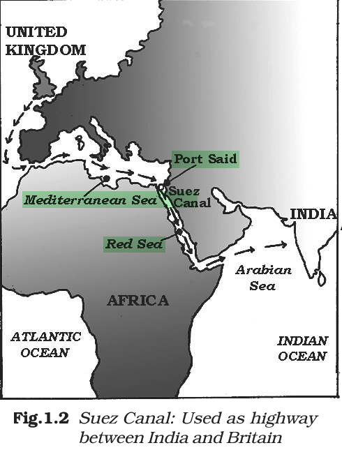
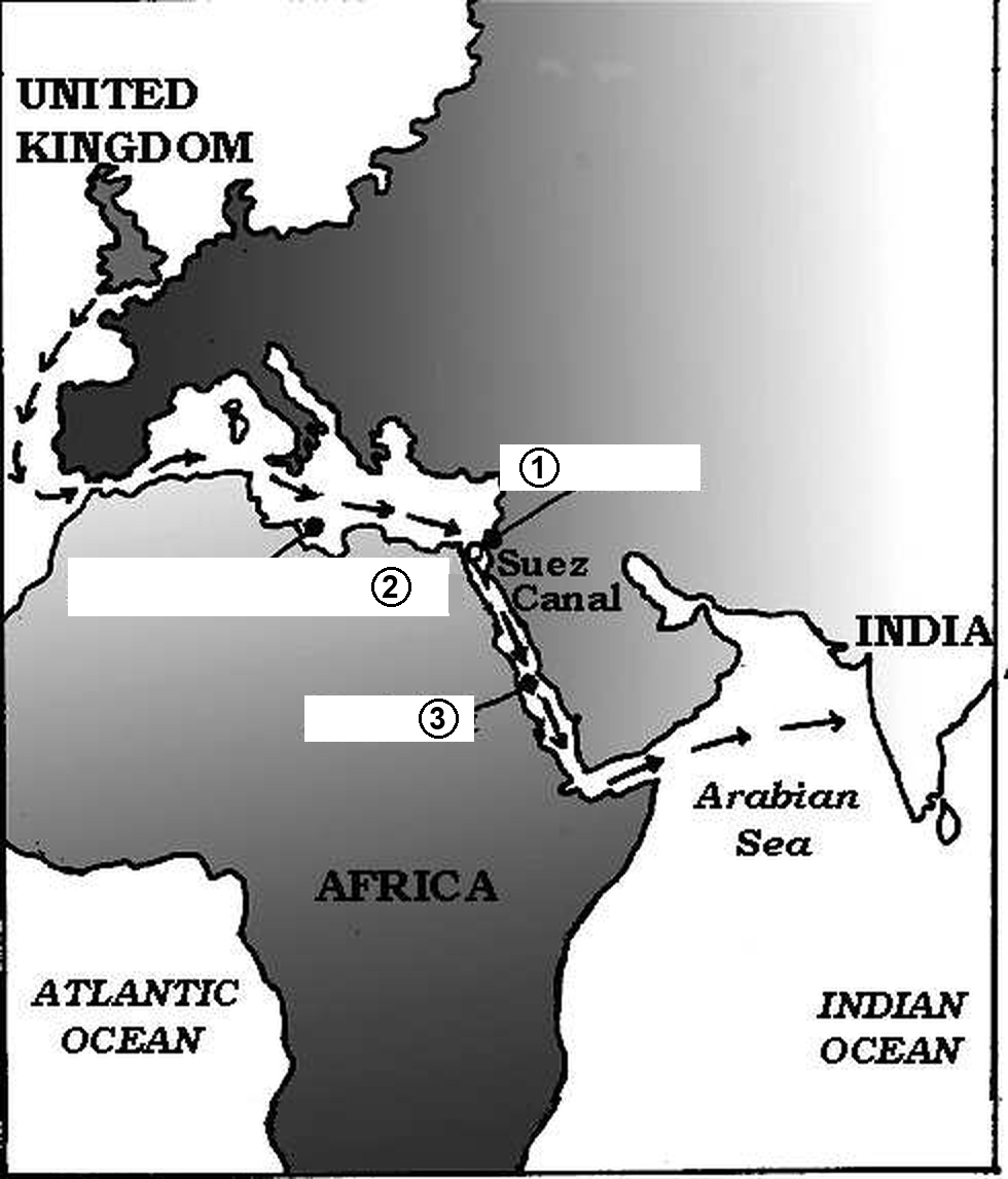
The map shows the route through the Suez Canal used as a highway between India and Britain. Identify the places marked (1), (2) and (3).
Answer & explanation
Correct answer: option 1
The correct answer is Option (1) → (1) Port Said, (2) Mediterranean Sea, (3) Red Sea
The Suez Canal links Port Said on the Mediterranean Sea with the Gulf of Suez, an arm of the Red Sea.
On the map, (1) is the port at the northern end of the canal, Port Said. (2) is the sea that ships cross from Britain, the Mediterranean. (3) is the sea south of the canal, the Red Sea.
Note: Maps count too. The labels on a small map in the chapter can turn into a question, so look at every map along with its caption.
NCERT (2026-27): “Box 1.3: Trade Through the Suez Canal Suez Canal is an artificial waterway running from north to south across the Isthmus of Suez in north-eastern Egypt. It connects Port Said on the Mediterranean Sea with the Gulf of Suez, an arm of the Red Sea. …”
|